
 |
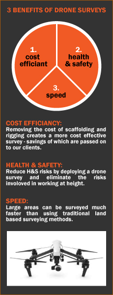
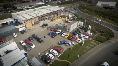
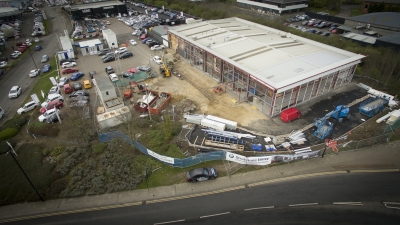
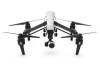
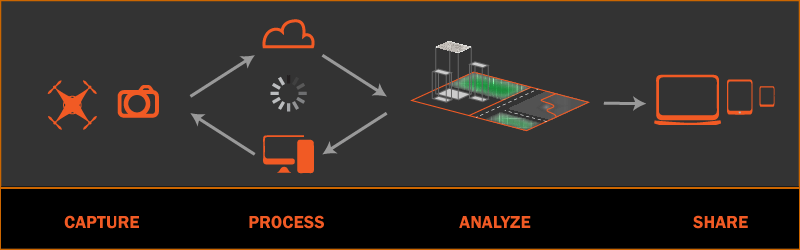 SERVICES - UAV AERIAL (DRONE) SURVEYS: Aerial surveys are a cost efficient and fast alternative to traditional land based surveys. We utilise our state of the art "DJI Inspire" drone to carry out a range of surveys according to client's requirements. BENEFITS OF AERIAL (DRONE) SURVEYS: · ACCURATE - Areas are surveyed using high precision cameras for 2D & 3D imagery. Using the GNSS satellite system for positional accuracy. Imagery linked to the OS National grid and Newlyn datum by establishing Ground Control Points accurate to 1cm. · SURVEY OF INACCESSIBLE / DIFFICULT AREAS - Inspection surveys of pylons, towers, wind turbines, roofs and dangerous terrain. · SAFER - Reduce the risks associated with working at height which is one of the many major causes of industrial accidents. · COST EFFICIANT - the speed and accuracy of which drone survey data is collected and passed onto the client will enable you to make better informed / quicker decisions - reducing costs and saving time. Removing the cost of scaffolding and rigging creates a more cost effective survey - savings of which are ultimately passed on to our clients. · SPEED - large areas can be surveyed much faster than using traditional land based surveying methods. From a drone survey we can offer aerial mapping, land surveys, topographical data, point clouds and volumetric analysis. 2D and 3D mapping/information (photogrammetry) is generated using the latest Pix4D software (see https://pix4d.com/hybrid-innovation/ for further information). Our surveyors currently hold PFCO licences. IMAGE GALLERY:
|
 |
||||||||||||


|
NAVIGATION HOME PROFILE SERVICES NEWS CONTACT OTHER GEOMATICS SERVICES 3-D LASER SCANNING HIRE |
CONTACT Geomatics UK Ltd Arch Centre For Enterprise, Suite F19 Lintonville Parkway, Ashington Northumberland, NE63 9JZ (view map) Tel: 01670 528401 Mobile: 07711 619438 enquiries@geomatics-uk.com |
SOCIAL MEDIA |
Copyright © 2015 Geomatics Uk Ltd