
 |
|
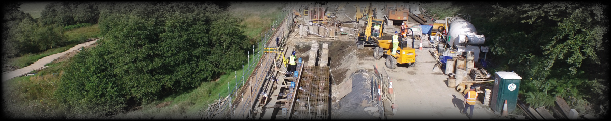
SERVICES - PRIMARY CONTROL INSTALLATION: Geomatics Uk Ltd offer installation of primary control using Trimble GNSS receivers establishing a primary control network. Setting control points calculation positions using the OS Active RTK network for precise positioning. Permanent ground markers established.
Accurate establishment and maintenance of a Primary Control Network is
essential to ensure successful dimensional control over a
project. We can provide survey control at all stages of a project whether it be a small or large scale scheme. Benefits of installing a primary control network:
·
Meet high tolerance demands of architects Why use Geomatics Uk Ltd for Primary Control Network: Our experience surveyors are specifically trained to use Trimble GNSS receivers supplemented with GNSS systems for larger developments We ensure integrity is maintained within your Primary Control Network ensuring high degrees of accuracy
Setting Out:
Site Control: Ordnance Survey Primary Control · Surveying Ground markers will be installed and held into position using postcrete
·
A Trimble R10 GNSS system will be used to
establish a local base station positioned to the Ordnance Survey
Active GNSS Network using observation data. This data will be
post processed using Trimble Business Centre.
·
A Site traverse will then be performed using a
Trimble/Lecia 1” Total Station and a traverse kit. The Raw
data will be calculated inside N4ce and a least square analyst
will be carried out.
·
A level traverse will then be performed using a
Leica DNA03 digital level and a 2m
Invar staff with bar
code. Primary Control (Local Datum)
·
Surveying Ground markers will be installed and
held into position using postcrete.
|
ACCREDITATIONS: We are CHAS, RICS, Chartered ICES and ISO 9001:2008 accredited ensuring our services, management procedures and systems are of the highest standard and always meet the needs of our customers. We are also registered with Construction Line.  |
|
NAVIGATION HOME PROFILE SERVICES NEWS CONTACT OTHER GEOMATICS SERVICES 3-D LASER SCANNING HIRE |
CONTACT Geomatics UK Ltd Arch Centre For Enterprise, Suite F19 Lintonville Parkway, Ashington Northumberland, NE63 9JZ (view map) Tel: 01670 528401 Mobile: 07711 619438 enquiries@geomatics-uk.com |
SOCIAL MEDIA |
Copyright © 2015 Geomatics Uk Ltd