
Geomatics Uk Ltd - Chartered Land & Building Surveyors
Geomatics UK Ltd is one of Britain’s foremost Chartered Land & Building Surveyors. We offer a range of comprehensive services to residential clients throughout the North East region including:-
· Building surveying services
· Plans for home extensions & building works
· Setting out of building plots
· Boundary dispute surveys
· Computer generated plans / drawings (CAD plans)
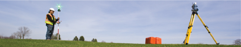
· Topographic surveys (Land Surveys)
Weare accredited / regulated by the following: CHAS, RICS, Chartered ICES and ISO 9001 - ensuring our customer service, management procedures and systems are of the highest standard and always meet the needs of our customers.
(For further details of each of the above accreditations, please see our "links" page where you may follow web links to each of the companies websites for further reading).
We cover the North East region including:-
Newcastle, Durham, Teeside, Tyneside (Tyne & Wear), Northumberland and Carlisle.
CONTACT US:

Geomatics UK Ltd
Arch Centre For Enterprise, Suite F19
Lintonville Parkway, Ashington
Northumberland, NE63 9JZ
(by appointment only)
View location map
Tel: 01670 528401
Mobile: 07711 619438
Email: enquiries@geomatics-uk.com